ASHEVILLE, N.C. (828newsNOW) — Strong storms capable of producing damaging winds and a few tornadoes could move through Western North Carolina early Monday as a powerful weather system crosses the region, forecasters said.
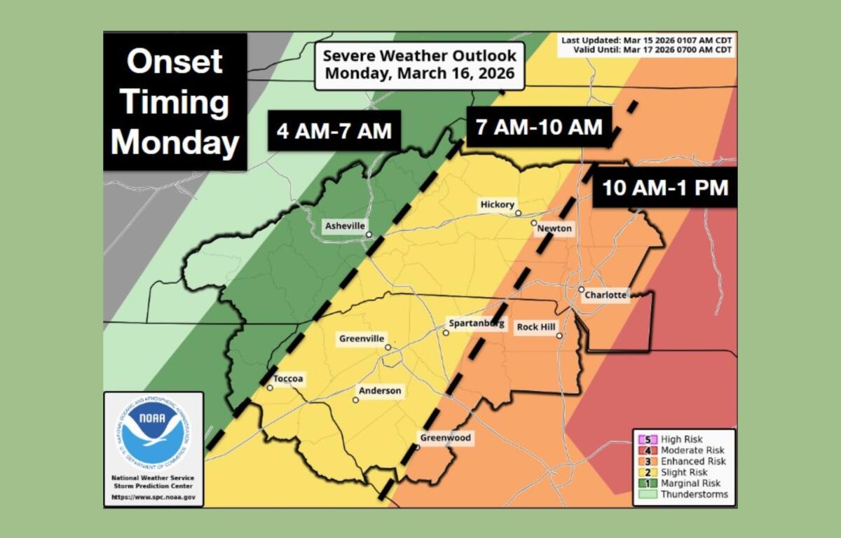
The U.S. National Weather Service office in Greenville-Spartanburg said a line of severe thunderstorms is expected to move across the North Carolina mountains between about 4 a.m. and 7 a.m. Monday, reaching areas east of the mountains later in the morning.
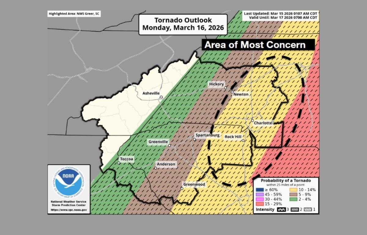
While the highest risk for severe weather is expected farther east of the mountains, forecasters said Western North Carolina could still see damaging straight-line winds and isolated tornadoes as the storms move through.
Scattered showers and a few thunderstorms are possible Sunday afternoon and evening ahead of the main system, but the more organized line of storms is expected overnight into Monday morning as a cold front pushes across the region.
Meteorologists say strong winds in the atmosphere combined with increasing moisture will create conditions capable of supporting severe storms. The primary concern is damaging winds, though brief tornadoes embedded within the line of storms are also possible.
Residents are urged to have multiple ways to receive weather warnings and be prepared to seek shelter if warnings are issued.
Behind the front, colder air will move into the region and conditions are expected to turn windy across the higher elevations.
The National Weather Service has issued a wind advisory for elevations above 3,500 feet from 4 p.m. Monday until 5 a.m. Tuesday for several mountain counties, including Buncombe, Haywood, Madison, Mitchell, Yancey, Swain, Transylvania and Jackson counties.
Forecasters say northwest winds of 20 to 30 mph with gusts between 50 and 60 mph are possible at the higher elevations.
The strong winds could blow around unsecured objects, down tree limbs and cause isolated power outages, according to the advisory. Drivers, especially those operating high-profile vehicles, are urged to use caution.
Rain is also expected to change to snow at the highest mountain elevations Monday afternoon, with light accumulations possible mainly above 3,500 feet.
Colder, drier air is expected to settle into the region Monday night through midweek, with overnight temperatures dropping to near or below freezing before warmer weather returns later in the week.
Officials encourage residents to stay weather-aware Monday morning as the line of storms moves through the mountains during the early commute hours.
Cities included in the wind advisory include Asheville, Waynesville, Burnsville, Marshall, Spruce Pine, Bryson City, Sylva, Brevard, Cashiers and the community of Faust, according to the weather service.