ASHEVILLE, N.C. (828newsNOW) — Cloudy skies hung over Asheville Wednesday morning, Nov. 4, as a cold front approached Western North Carolina, bringing the promise of rain and a few thunderstorms.
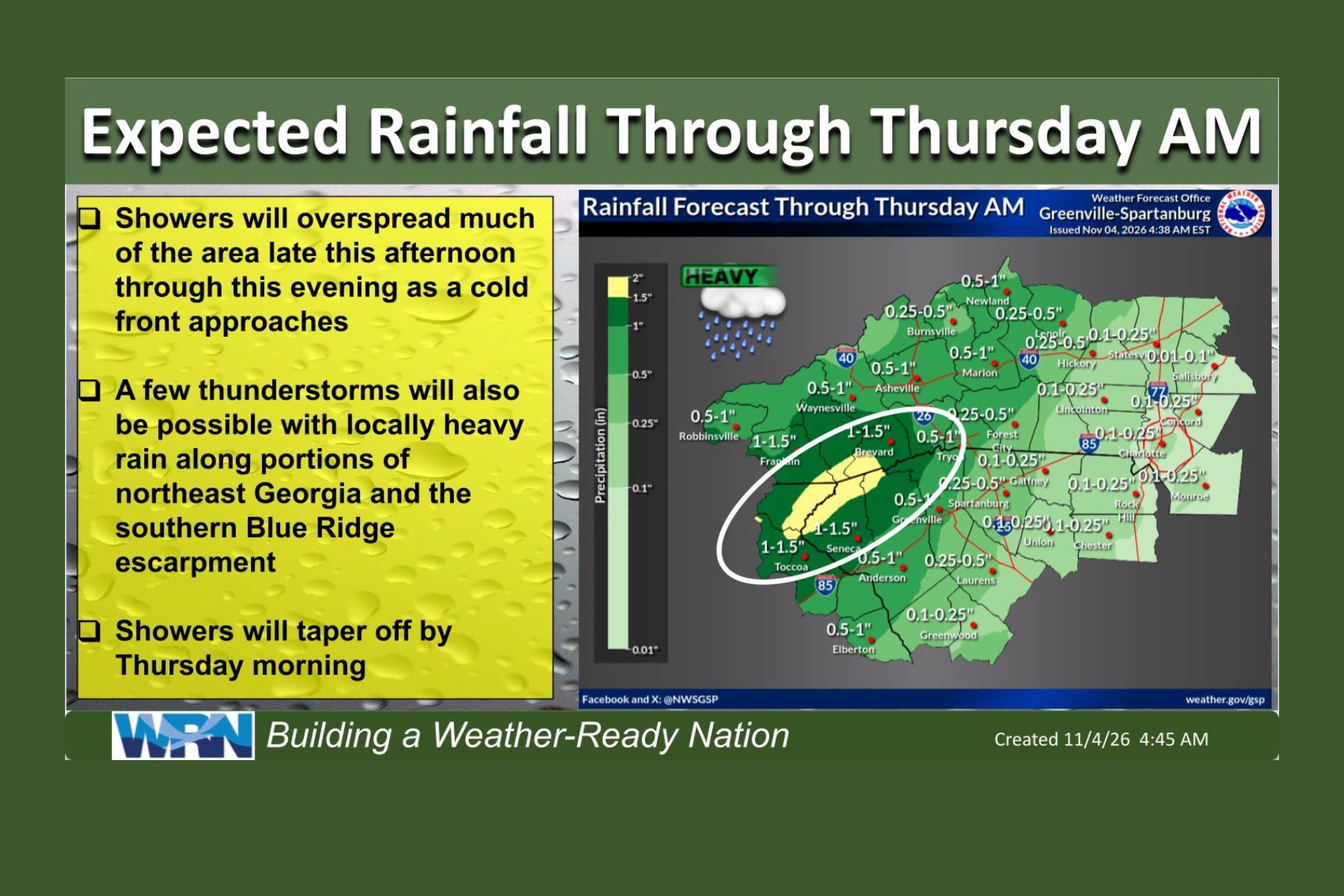
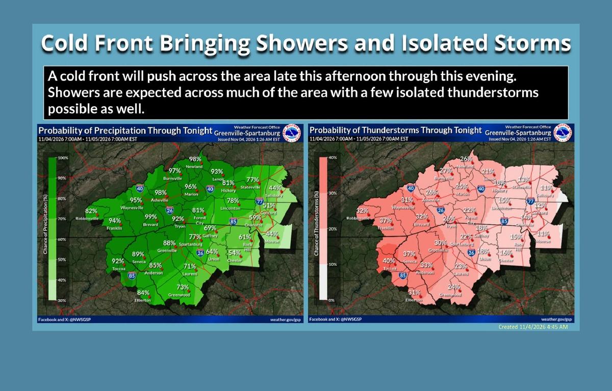
The National Weather Service in Greenville-Spartanburg says showers will spread across much of the region late Wednesday afternoon and continue into the evening as the cold front moves through.
A few thunderstorms are also possible, with some bringing locally heavy rain. Forecasters say the greatest potential for heavier rainfall will be along the southern Blue Ridge escarpment and in northeast Georgia.
Much of the mountain region could receive between a half-inch and an inch of rain, with higher amounts possible in some areas. The forecast calls for 1 to 1.5 inches around Brevard and Franklin.
In Asheville, the chance of rain increases throughout Wednesday, with showers likely after 2 p.m. The high will be near 66 degrees, with southeast winds gusting as high as 23 mph.
Rain is expected to become more widespread Wednesday night, when Asheville has a 100% chance of precipitation. Between a half-inch and three-quarters of an inch of rain is possible overnight, with temperatures falling to around 58 degrees.
The Weather Service says an isolated strong or severe thunderstorm can’t be ruled out, although widespread severe weather is not expected. There is also a low-confidence risk of isolated flash flooding, particularly along the escarpment and foothills.
Rain gives way to warmer Thursday
Showers should taper off by Thursday morning, but drivers could encounter widespread dense fog, especially before 9 a.m.
Once the fog clears, Asheville should see some sunshine, with temperatures climbing to around 75 degrees — well above normal for early November.
Thursday night will be mostly cloudy, with a low around 52.
Some additional showers remain possible across the region Thursday and Friday as another weather system moves through, although Asheville’s latest forecast calls for mostly sunny skies Friday and a high near 70.
Cooler weather returns for the weekend
The unusually warm weather won’t last.
Forecasters expect drier conditions and temperatures closer to seasonal averages by Saturday as high pressure builds into the region.
Overnight lows could fall into the 30s across the mountains this weekend and early next week, with upper 30s and 40s expected elsewhere.
In the meantime, anyone heading out Wednesday afternoon or evening should be prepared for rain, especially during the drive home.