ASHEVILLE, N.C. (828newsNOW) — Thunder, lightning and steady rain moved across Western North Carolina early Tuesday, bringing the first meaningful rainfall the region has seen in weeks.
The National Weather Service office in Greenville-Spartanburg issued several Special Weather Statements as storms tracked through the mountains overnight and into the morning. Those alerts expired around daybreak as the system weakened.
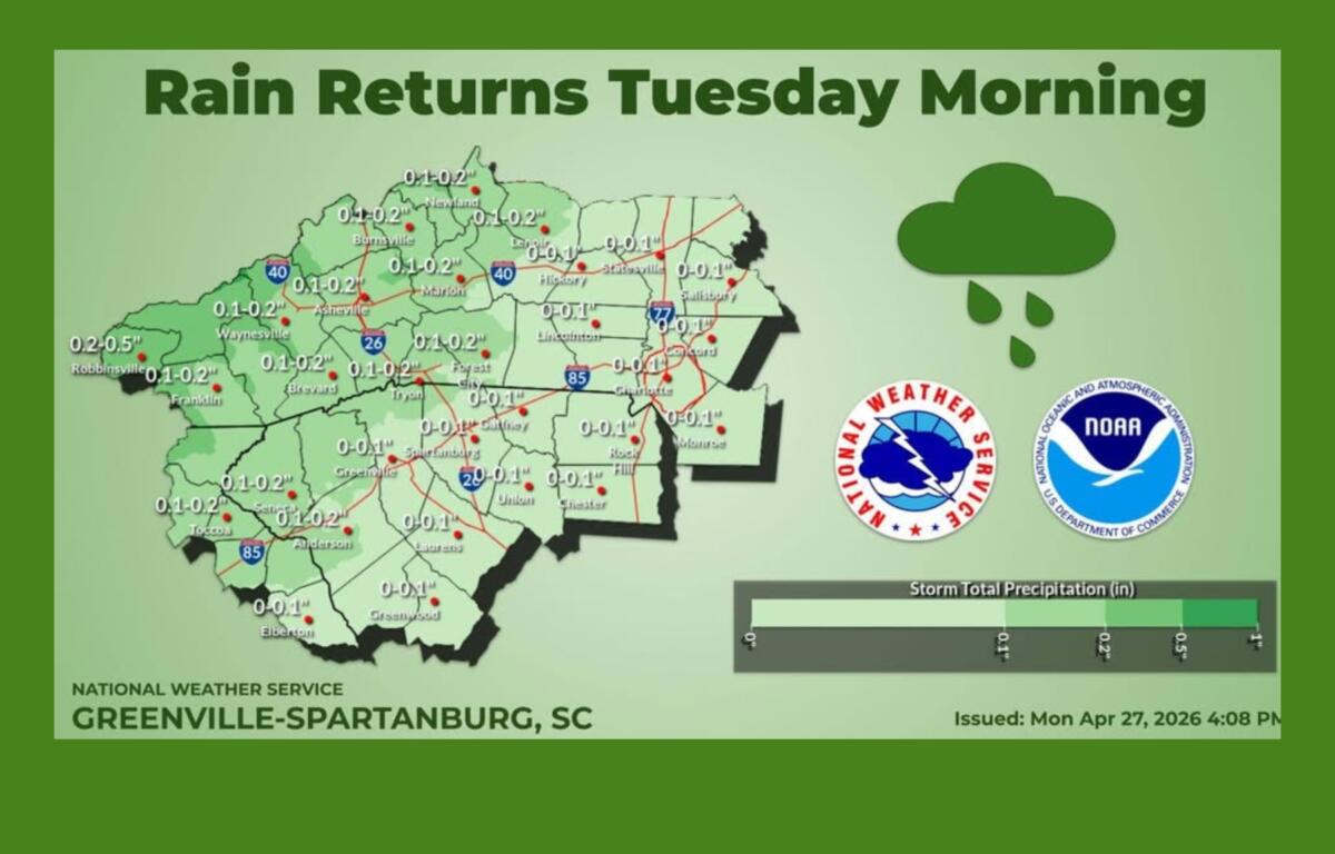
Forecasters said showers and a few thunderstorms would continue through the morning hours before drier conditions developed later in the day. Some storms could produce gusty winds, but widespread severe weather is not expected. Rainfall totals are generally expected to be beneficial.
Another round of storms is expected late Tuesday night into Wednesday as a cold front approaches the region. The weather service said precipitation chances will increase, with higher rainfall amounts possible, though flooding is not anticipated. A marginal risk of isolated severe storms exists Wednesday, mainly across North Carolina and parts of the eastern Upstate of South Carolina.
After the front moves through Wednesday night, cooler air will settle into the region. Gusty winds are possible along and just behind the front into early Thursday, though impacts are expected to remain limited. High temperatures are forecast to drop to near or slightly below normal Thursday and fall further below normal by Friday.
A period of quieter weather is expected late in the week before another system arrives Friday night into Saturday. While severe weather is not currently anticipated, forecasters say it should bring another round of much-needed rainfall to the area.
In Asheville, the forecast calls for a high near 76 degrees Tuesday with showers and thunderstorms mainly before noon, followed by gradual clearing. Rain chances increase again late Tuesday night and peak Wednesday, when showers and storms are likely and winds could gust above 20 mph. Conditions turn cooler and drier Thursday, with highs in the upper 60s.