ASHEVILLE, N.C. (828newsNOW) — Winter-like conditions are set to return to Western North Carolina this weekend following a period of heavy rain, gusty winds and unseasonably warm temperatures, according to the National Weather Service.
Forecasters with the National Weather Service office in Greenville-Spartanburg said widespread rain is expected tonight into Saturday across the southwest Appalachians of North Carolina, South Carolina and Georgia. While flooding is not anticipated because of dry soils and low stream levels, localized downpours could lead to isolated issues.
Thunderstorms or intense showers Saturday could produce strong wind gusts and, in rare cases, a brief tornado, forecasters said. The storms may cause minor structural damage, downed tree limbs or isolated power outages.
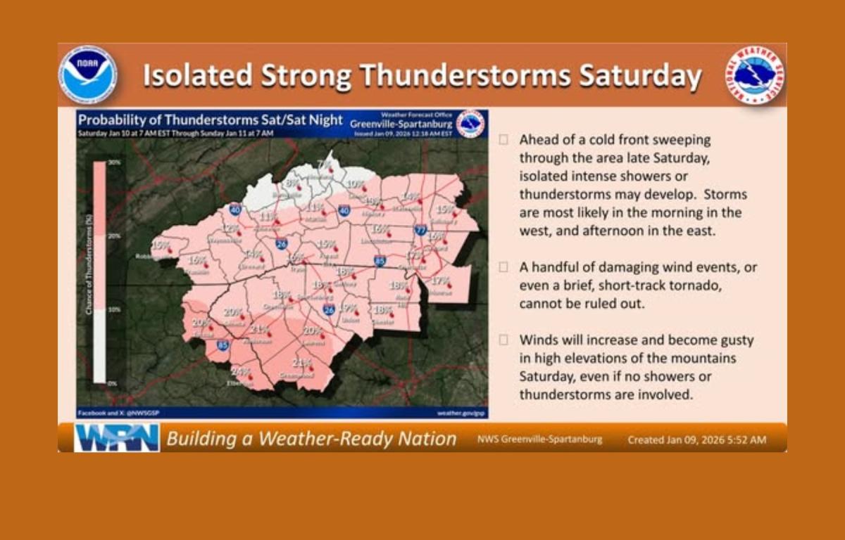
Gusty winds are expected to develop by Saturday morning in the higher elevations and strengthen into Sunday as they spread into lower elevations. With soils becoming saturated from rainfall, a few trees could uproot, the weather service said.
Temperatures will remain unseasonably warm through Saturday before a strong cold front pushes through the region Saturday night. Much cooler and drier air will follow, with a sharp temperature drop expected from Saturday to Sunday.
In Asheville, highs near 65 degrees are forecast today and Saturday, with rain likely both days. Rain could be heavy at times Saturday, with total rainfall amounts of up to three-quarters of an inch possible. Overnight temperatures are expected to fall sharply Saturday night, dropping into the low 30s as northwest winds increase.
Sunday is expected to be mostly sunny but blustery, with highs near 41 degrees and wind gusts approaching 40 mph. Sunday night temperatures could fall to around 20 degrees.
Forecasters say dry and seasonably cold conditions are expected Monday and Tuesday. Another weather system could bring additional precipitation by midweek, with colder air in place raising the possibility of snow in Asheville and areas to the northwest by Wednesday or Thursday.
Meteorologists say the pattern shift favors colder, more wintry weather through mid- to late-January, though no single storm system is locked in at this time.