ASHEVILLE, N.C. (828newsNOW) — A chilly start Tuesday across the Asheville area is expected to give way to milder temperatures and partly sunny skies as drier air moves into the region, according to the U.S. National Weather Service Greenville-Spartanburg.
Forecasters said near-critical fire weather conditions are expected Tuesday afternoon outside the North Carolina-Tennessee border area, where recent snowfall has helped dampen fuels.
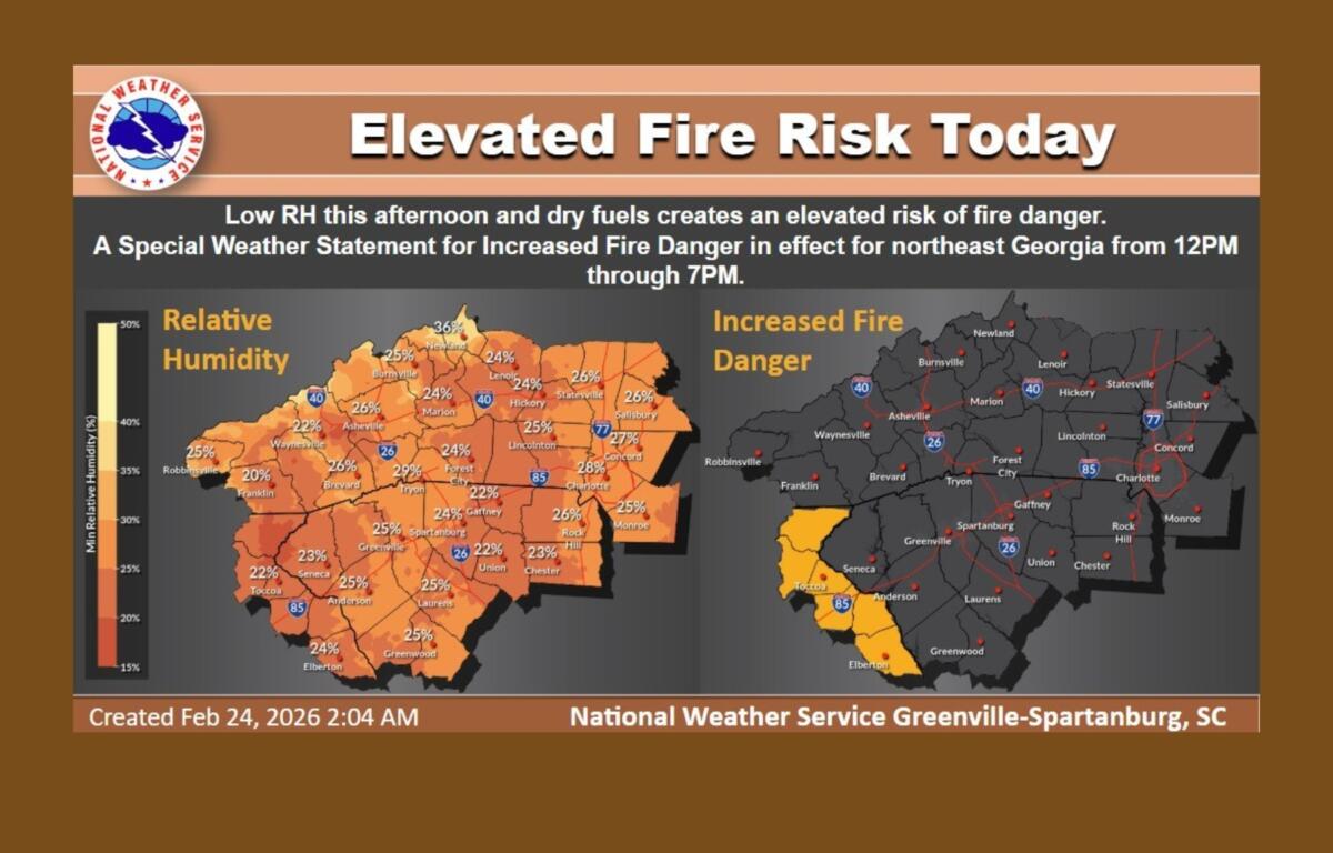
Relative humidity levels are forecast to drop into the 15 percent to 20 percent range in parts of northeast Georgia, with 20 percent to 25 percent elsewhere across the coverage area. Winds are expected to shift to the southwest by afternoon, with gusts between 10 and 15 mph. The combination of low humidity and dry fuels will make outdoor burning dangerous, officials said.
Gusty conditions are also expected in the mountains. Stronger west to southwest winds are possible late Tuesday night into Wednesday, particularly across higher elevations, where gusts around 40 mph could occur in wind-prone areas. Winds of 20 to 30 mph are possible across much of the region Wednesday afternoon as moisture gradually increases. Although humidity levels are expected to rise into the 30 percent to 45 percent range by midweek, fuel moisture is likely to remain low, keeping fire danger somewhat elevated.
Temperatures are forecast to steadily warm through the week and into the weekend. In Asheville, Tuesday’s high is expected to reach near 48 degrees under partly sunny skies, following a morning of cold temperatures. Lows Tuesday night will dip to around 31 degrees under mostly cloudy skies.
Wednesday is expected to be partly sunny with a high near 59 degrees. Winds could gust up to 18 mph. A 50 percent chance of rain develops Wednesday night, mainly after 10 p.m., with lows around 42 degrees.
Rain is likely Thursday, with an 80 percent chance of precipitation and a high near 60 degrees. Showers may continue into Thursday night before tapering off. Forecasters said a cold front moving through early Thursday into Friday could also bring a chance of thunderstorms.
By Friday, skies are expected to clear to mostly sunny with a high near 60 degrees, followed by partly cloudy conditions Friday night and a low around 38.
Officials urge residents to avoid outdoor burning during periods of increased fire danger and to use caution amid gusty winds and changing weather conditions.